HOC518 Tasmania
Click image to enlarge
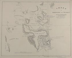
Title:
Chart of Forestier's and Tasman's Peninsulas
Cartographer: George Frankland
Technique: Lithograph
Source: Report of House of Commons
Select Committee on Transportation
Published: 1837
Image Size: 380x310mm
Price AUD: $475.00
Condition report available on request.
To purchase this print please call
Full Circle on (03)9819 4042
or email us.
<<back